A Birds-Eye View-Map of Malta
£578

You are now following Charts. You can manage alerts in your account settings.
You have unfollowed Charts.
A Birds-Eye View-Map of Malta
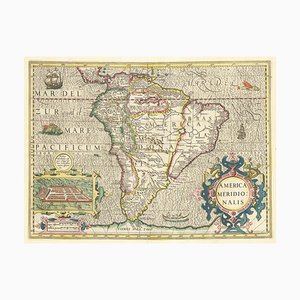
Early 17th Century Dutch Map of South America, 1633
18th Century Map of Arabia with a Fine Border
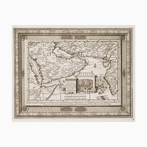
Figure Map of America

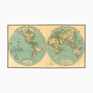
Late 19th Century Double-Hemisphere World Map in Cyrillic
17th Century Celestial Chart Showing the Ptolemaic Planetary Orbits

Pictorial Map of the World Promoting Protestant Missionary Work

Dutch County Map of Cheshire by Janssonius, 1660s

Taiwan Map from Dutch East India Company, 1724

Large Chart of Jamaica, 1753

17th Century Prospect of Lisbon

Large-Scale Survey of London Map with Marylebone & St Pancras

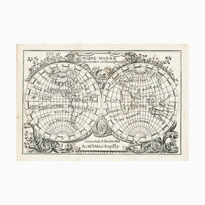
Miniature Double-Hemisphere World Map by J. Expilly, 1765
16th Century Miniature Map of Ischia by B. Langenes, 1599

Prospect of Munich, Early 18th Century

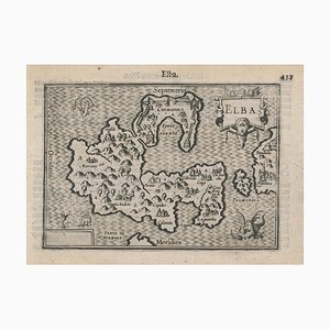
16th Century Miniature Map of Elba by B. Langenes, 1599
Mid-18th Century Map of Taiwan by Bellin, 1748

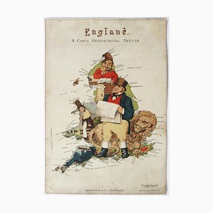
Allegorical Map of England

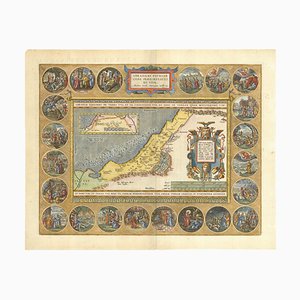
Map of Classical Arabia

Panorama of Stockholm

Panorama of Vienna Under Siege by the Ottomans

Unusual Balloon View of Brighton, 1840s

Caricature Map of Italy

17th Century Plan of Valletta

Caricature Map of England and Wales
The Route of the Spanish Armada Around the British Isles

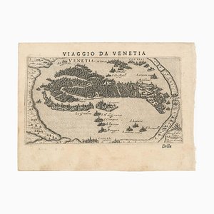
First Issue of Rosaccios Map of Venice
Napoleon in Exile on St Helena

16th Century Italian Map of Cambridge

17th Century French Map of Arabia

Maps of the World & Continents, Set of 7

A Birds-Eye View of Paris

Classic Carte-À-Figure Map of the Netherlands & Belgium

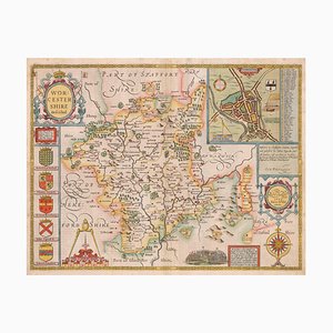
17th Century Map of Worcestershire, 1676
Ptolemaic Map of Italy

A 17th Century Engraving of the Zodiac Sign Leo

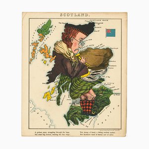
Satirical Map of Scotland
16th Century Miniature Map of Cyprus

17th Century Map of Luxembourg

Map of the British Isles with Decorative Borders

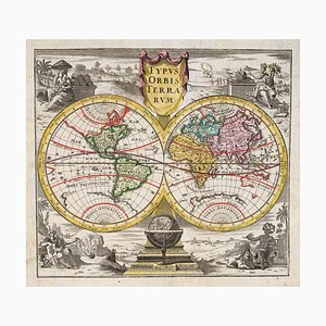
18th Century Double-Hemisphere World Map
Large and Detailed Chart of the Bahamas, 1700s

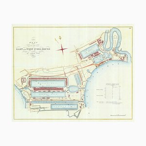
Detailed Plan of Londons Docklands
Pictorial Map of Russia

The City and Whitechapel from a Large-Scale Survey of London

Covent Garden and Soho from a Large-Scale Survey of London

Early 17th Century Map of Wales, 1619

Pimlico and Belgravia from an Important Large-Scale Survey of London

Plan to Redevelop the Corner of Park Lane and Piccadilly

Detailed Town Plan of Madrid

Map of North America During the Mississippi Bubble

Four-Sheet Wall Map of the Far East, Set of 4

17th Century Panelled Map of the Holy Land

A 17th Century Engraving of the Zodiac Sign Sagittarius

Caricature Map of Wales

18th Century Maritime Explanatory Print

The Peregrinations of Abraham, 1603
Orteliuss Landmark Map of China

18th Century Two-Sheet Map of Ancient Greece from Aeg

Satirical Map of Ireland

Pictorial Map of Wales

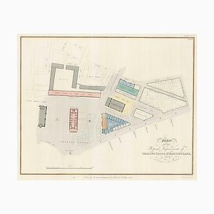
Planned Redevelopment of Charing Cross
17th Century Map of China

Wall Map of Scotland

Two-Sheet Map of Ireland

Chart of the Apparent Motions of Mars, Jupiter & Saturn

18th Century Map of Scotland

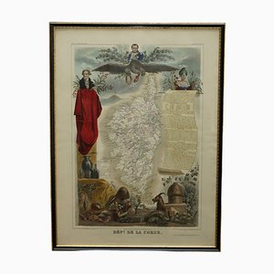
French Hand Watercolour Map of Dept des la Corse, 1856
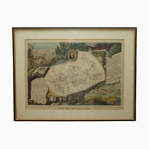
French Hand Watercolour Map of Dept des Hautes Pyrenees, 1856

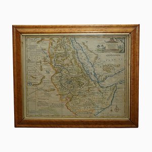
Watercolour Map of East Africa by Eman Bowen, London, 1744
French Hand Watercolour Map of Dept des Hautes Pyrenees, 1856
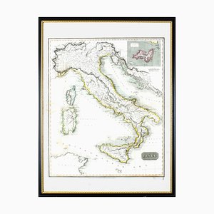
Map of Italy Drawn & Engraved by R. Scott for Thomsons, Edinburgh, 1814
Trending