Vintage Linen School Card Seals
£244

You are now following Charts. You can manage alerts in your account settings.
You have unfollowed Charts.
Vintage Linen School Card Seals
Pictorial Map of South Africa from the Second World War, 1940s

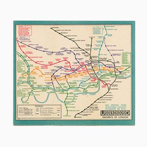
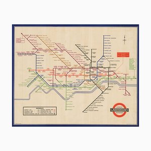
Last Pre-Beck Pocket Map of the London Underground, 1930s
Map of the Environs of Hong Kong

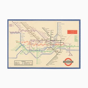
Map of the London Underground, 1930s
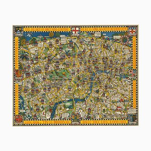
The Famous Wonderground Map of London, 1920s
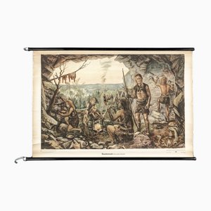
Charts of Maps from Ice Age Man
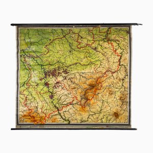
Charts of Physical Maps from North Rhine Westphalia NRW
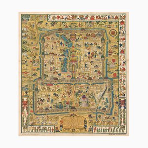
Pictorial Map of Beijing by Frank Dorn, 1936
London Transport Underground A Double Crown Poster Map of the Tube by Beck, 1935
Vintage Tube Poster for Bond Street Station Chart, 1934

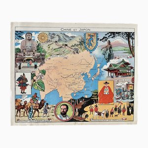
Illustrated Map of China and Japan by Émile-Joseph-Porphyre Pinchon, 1948
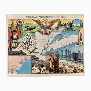
Illustrated Map of New York by Émile-Joseph-Porphyre Pinchon, 1948
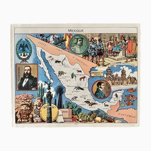
Illustrated Map of Mexico by Émile-Joseph-Porphyre Pinchon, 1948
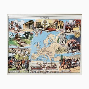
Illustrated Map of Europe by Émile-Joseph-Porphyre Pinchon, 1940s
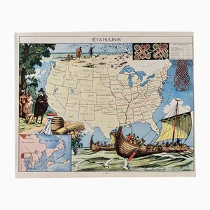
Illustrated Map of the United States by Émile-Joseph-Porphyre Pinchon, 1948
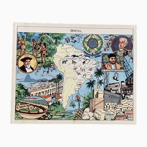
Illustrated Map of Brazil by Émile-Joseph-Porphyre Pinchon, 1948
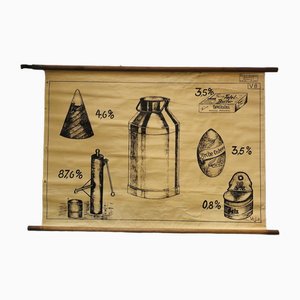
Vintage Educational Board Milk by Georg H. Knickmann, 1940s
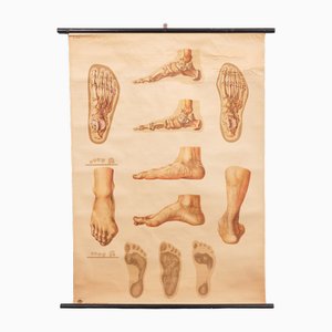
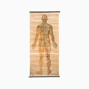
Vintage Pull-Down Medical Wall Chart Illustrating Orthopedics of Foot, 1935
Modern Italian Topographic Geographical Map in Wood Frame of Europe, 1950s-1990s
Bone Structure Medical Chart, 1947

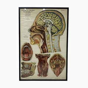
American Frohse Anatomical Chart, 1947
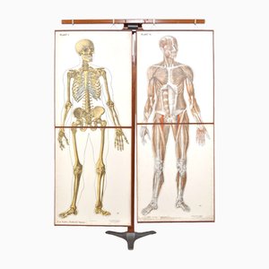
Human Foldable Anatomical Wall Charts, 1920s, Set of 2
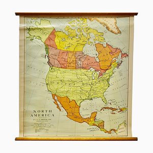
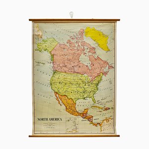
Large University Chart Political Map of North America by Bacon, 1920s
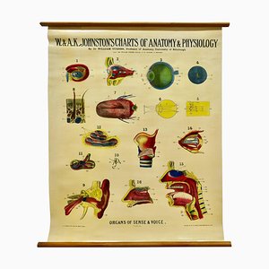
Large University Anatomical Chart of Organs of Sense & Voice by Dr. William Turner, 1920s
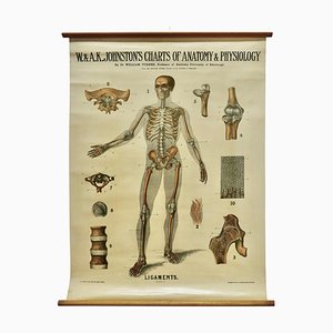
Large University Anatomical Ligamnets Chart by Turner, 1920s
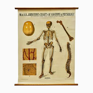
Large University Anatomical Bones Chart by Turner, 1920s
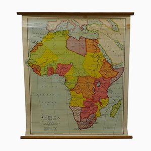
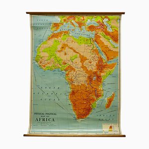
Large University Chart Physical Map of Africa by Bacon, 1920s
Large University Chart Political Map of North America by Bacon, 1920s
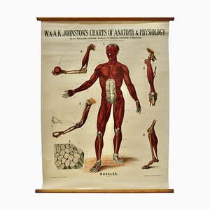
Large University Anatomical Muscles Chart by Turner, 1920s
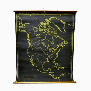
Black University Chart Map of North America, 1920s
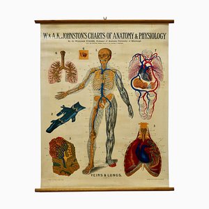
Large University Anatomical Chart Veins and Lungs by Turner, 1920s
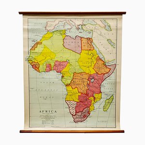
Large University Chart Africa by Bacon, 1920s
Charts of Physical Maps by G.W. Bacon, 1920s
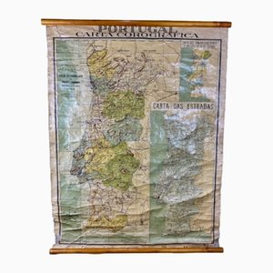
Chorographic Map of Portugal, 1942
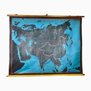
Beech Asia Map, 1940s
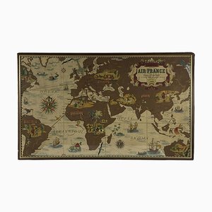
Air France Nova and Vetera Poster Map by Lucien Boucher, Paris, France, 1939
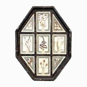
Vintage Herbarium in Glazed Wooden Frames, Florence, 1941
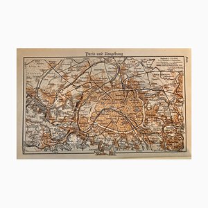
Map of Paris, 1937
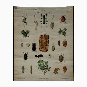
Old Vintage Beetles Insects Overview Wall Chart Poster
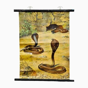
Scenery with Cobras Snake Poster Print Pull-Down Wall Chart
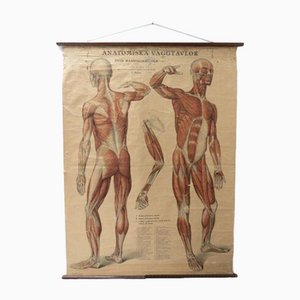
Vintage Swedish Anatomical Medical Wall Hanging
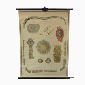
Vintage Educational Tapeworm Anatomy Chart, 1930s
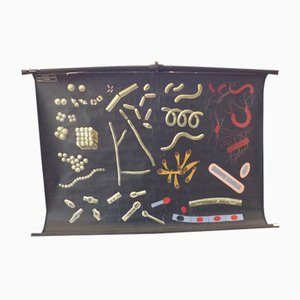
Vintage Educational Bacteria Chart, 1930s
Opera Cartographic Mirabile Card from North Sea to the Mediterranean and Ethnographic Europe from C. T. I. Milan, Italy, 1939, Set of 3
Anatomical Chart from the German Hygiene Museum, Dresden, Germany, 1950s
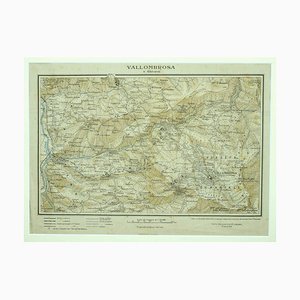
Unknown - Map of Vallombrosa - Florence 1926
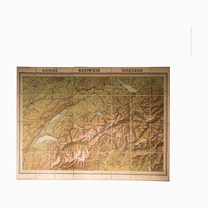
Vintage Geographical Map of Switzerland, 1930s
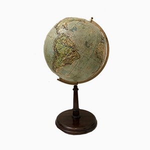
Vintage Relief Globe from Vallardi
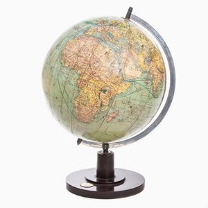
Vintage Slate Globe from Räths

German Art Deco Globe from Columbus Verlag, 1941
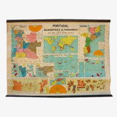
Vintage Portugal School Map, 1940s
Trending